Expected goal: Facing the needs of various industries for 3D geographic information, aiming at the potential advantages and processing difficulties of multi-line array aeronautics, aerospace images, large-format multi-overlap aeronautical digital images, laser scanning data, and China’s high-resolution stereo mapping satellites, accurate image positioning, digital ground model extraction, semantics The extraction of information and the updating of GIS data and the reconstruction of urban three-dimensional models have been deeply studied, forming a series of practical photogrammetry technology and corresponding software, which are widely used in military and civil surveying and mapping production.
Main research content:
(1) Theory and method of high-precision positioning of new sensors in aerospace and aviation
In view of the problems existing in star positioning, the high-reliability star map recognition algorithm and the corresponding navigation star table structure are studied, and the method of improving the accuracy of star camera calibration by using the continuous star imager, so that the accuracy of star posture fixation reaches less than 3 seconds.
The geometric correction theory and the design method of ground geometric correction field of satellite remote sensing imaging system are studied to realize the in-orbit geometric correction of satellite imaging system.
According to the imaging geometry relationship of different sensors, the imaging geometry model of aerospace and aerial image is established, and the orbital, attitude and POS data of aerospace images are used to study the unified representation and aberration method of multi-source image imaging models to realize the integration of multi-platform and multi-sensor images. “Processing to achieve high-precision positioning of images without ground control points.
(2) Theory and method of multi-source and multi-time remote sensing image registration
Aiming at the difficulty of image matching caused by geometric deformation and radiation distortion of multi-source images, the stable invariant characteristics and extraction algorithms of multi-source and multi-phase remote sensing images are studied, and the similarity measurement and matching strategies suitable for multi-source image matching are determined to achieve visible light and visible light, visible light and infrared, optics and SAR, and The registration between different types of images such as LIDAR point cloud and optical image.
(3) Theory and method of multi-angle image matching and 3D model reconstruction
The feature extraction, geometric constraints and feature matching of multi-angle and multi-baseline images are studied, and a high-density digital surface model is established through the robust matching of point features, line features and surface features.
The establishment and representation of linear features, surface feature extraction and three-dimensional modeling models based on high-density digital surface models and multi-angle images are studied to realize the automatic reconstruction of urban three-dimensional models.
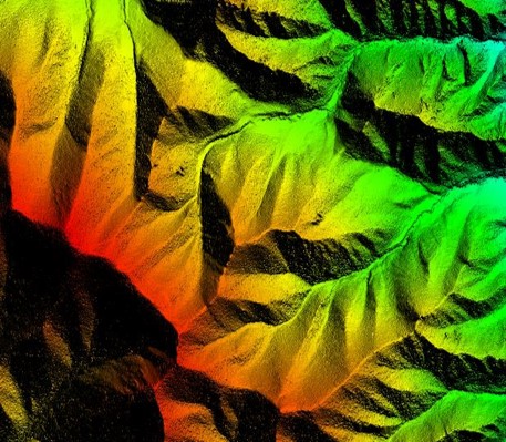
(4) LIDAR data processing and information extraction
The preprocessing and visualization of LIDAR point cloud data are studied to realize the automatic filtering of point cloud noise, the splicing and suture of airborne laser data and ground laser data, and the real-time loading and visualization of massive point cloud data. The classification of LIDAR point cloud data and the separation of various features are studied to realize ground, vegetation, Automatic extraction of buildings and other areas.
The extraction of linear and surface features of LIDAR point cloud data is studied to realize the automatic extraction of building roof and three-dimensional model reconstruction. The integrated processing of LIDAR point cloud data and optical image is studied, and the registration of point cloud data and image data is realized, and the extraction of point cloud data features and image data feature extraction are realized. Take interaction, complementarity and joint balance.
The application of LIDAR data in highways, railways, power, forests, rivers and oceans and other fields is studied to realize the construction measurement of highways, railways and power lines, forest heights, area, and interest extraction of river coastal zones.
The information extraction technology of LIDAR waveform data is studied. This paper studies the relationship between LIDAR waveform data and ground slope, roughness and material, how to use waveform data to improve the accuracy of feature extraction and classification, as well as the application and processing technology of waveform data in specific fields such as forests.
(5) Construction of Digital City Model and Protection of Digital Cultural Heritage
Comprehensively using existing planning data, aeronautical LIDAR, ground LIDAR, aerial photography, ground photography and other data sources, we study the integration technology of digital aerial cameras, GPS, IMU and airborne laser scanning systems and other sensors, automatically determine the external orientation elements of each image, and realize each shadow. Like data matching and registration; the information extraction and modeling technology of laser scanning data and stereo image data are studied to realize the automatic establishment of three-dimensional digital city model.
Comprehensively use laser scanning and close-up photography to study the data acquisition, modeling and visualization of cultural heritage such as ancient buildings, Buddha statues and murals.
(6) Development of a new generation of photogrammetry software
(a) Multi-source image aerial triangulation software
The automatic matching and unified space three processing of the same name of multi-platform and multi-sensor images are realized by using the orbital fixing and POS data of aerospace images.
(b) New generation of digital photogrammetry system
Make full use of the massive storage capacity and parallel computing power of parallel processors such as blade machines to realize the hybrid processing of multi-source image data, realize the automatic empty three- and multi-overlapping image object matching, the rapid generation of dense digital surface models, the production of real imagery, the automatic extraction of roads and buildings, Automatic reconstruction of three-dimensional urban model.
(c) LIDAR data processing system
Realize massive LIDAR point cloud data filtering, data mosaic, rapid visualization, DEM extraction, features extraction, 3D modeling and professional applications.