Expected goal: Achieve innovative results and cultivate high-quality professionals in basic research and applied research directions such as 3S integration, mobile space information acquisition, GIS-T, industrial measurement, etc., realize the combination of “production, learning and research”, and launch the LBS middleware platform. Carry out systematic research from the aspects of multimedia network geospatial information technology, multimedia communication and information processing technology, build an advanced multimedia communication and information processing theoretical research and application center with a certain impact on the world and domestic, and obtain a series of high-quality results.
Main research content:
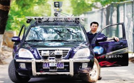
1) Multi-sensor integration and spatial information acquisition
The synchronous and asynchronous control of multi-sensor integration system, multi-sensor integration model, multi-sensor integration and data processing, multi-sensor and 3S integration are studied.
2) Laser scanning data processing and application
The integration of feature extraction algorithms, laser scanning and photogrammetry, feature extraction and modeling accuracy evaluation, the extraction accuracy and impact of different features, the reliability of data processing, data acquisition and processing methods under specified precision conditions are studied.
3) Spatial Information Service (LBS)
Study LBS industrialization specifications, LBS data acquisition and update platform, high-performance LBS middleware platform, and LBS application terminal development platform.
4) GIS-T, Intelligent Navigation and Service
Study GIS-T theory and technology, intelligent navigation and service.
5) Machine vision and industrial measurement
Closely track the latest research results at home and abroad, pay attention to the research of machine vision and lidar, POS, structural light and other integration methods and technologies, and improve the accuracy, speed and reliability of three-dimensional measurement, especially in the direction of industrial measurement technology, intelligent transportation technology, cultural relics and archaeological application research and other fields.
6) Intelligent sensor network
The application of RFID and intelligent sensor network in surveying and mapping, intelligent transportation, industry and other fields is studied, and progress has been made in the direction of automatic vehicle identification based on RFID, vehicle-vehicle and vehicle-road collaboration based on intelligent sensor network, and monitoring and monitoring system based on RFID and intelligent sensor network.
7) Multimedia network geospatial information technology
Research on space information applications, security technology, distributed massive spatial information storage, multimedia digital earth key technologies, multimedia collaborative GIS technology.
8) Multimedia communication and information processing technology
Research on large-capacity and high-reliability data communication technology, multi-sensor network technology, visual communication, multi-point audio and video communication technology and multimedia communication network QoS technology, large-capacity video switching and routing technology, embedded multimedia communication technology, video coding technology based on new communication networks (broadband, wireless) Technical and multimedia CTI technology and its emergency services.
9) Real-time communication technology of on-board and airborne space information
For the research and application of space information integration of space, sky and earth, the large-capacity wireless data communication and switching technology based on vehicle-board, airborne and other motorized high-speed mobile environments are studied, and the principle and network realization, communication control and service quality assurance mechanism, and data transmission of high-speed data transmission in high-time-varying and dynamic environments are studied. The theory and method of transmission security and confidentiality, and the combination model of spatial information application system.